Nakayama is in between Narita And Haneda International Airport
<クッキーについての同意並び欧州居住者向けプライバシーポリシー>
中山・下総・散歩道
最寄駅と所在The location and access to landmarks
The Maps to the Landmarks Introduced In Nakayama Shimousa
Some maps showing accessibilities and the neighborhoods of the landmarks introduced in this website 'A Walk On Nakayama Shimousa'. Some kinds of maps would be prepared such as famous spots of viewing cherry blossoms, roses, irises and so forth. If you visit them, please see and use these maps and PDFs on this page.The List of the Maps
- Baraki and Myoden Areas
- along Edogawa River
- near Funabashi Station
- along Furukawa Water Park and in Kasai
- Gyotoku Teramachi Areas
- near Ichikawa Ono Station
- near Ichinoe Station
- near Imai no Watashiato (the remains of the Ferry at Imai)
- near Katsushika Hachimangu
- near Keisei Koiwa and Edogawa Station
- near Komatsugawa Sakaigawa Water Park
- along Mamagawa River
- near Mamasan Guhoji and Satomi Park
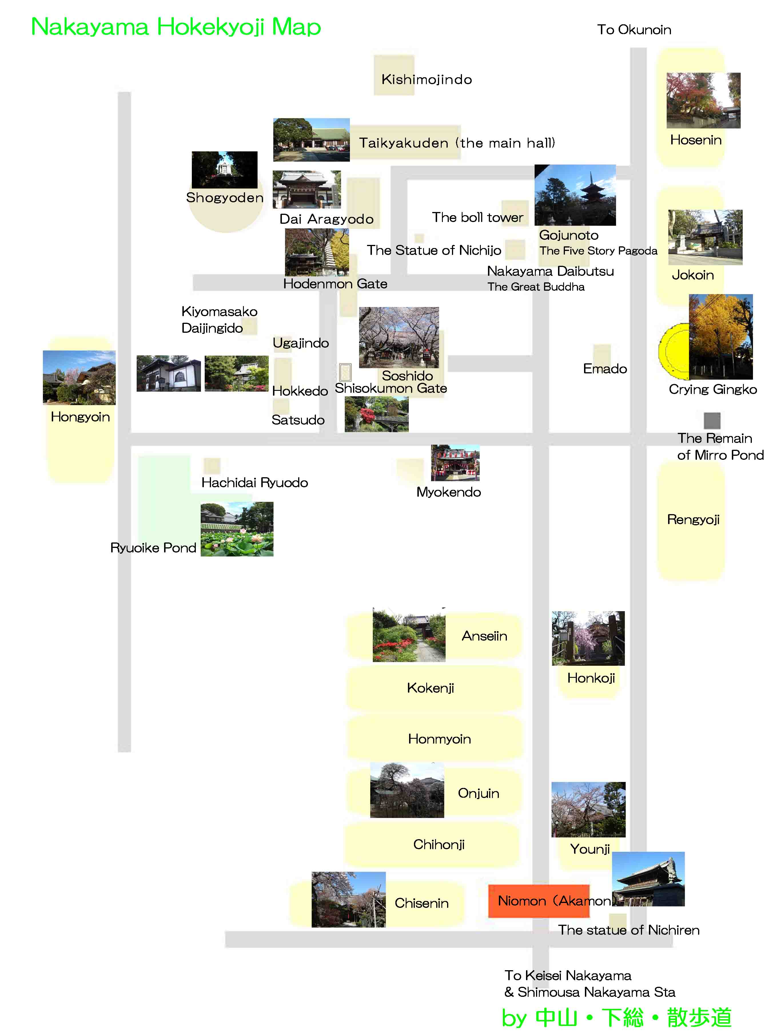
- Nakayama Hokekyoji Temple
- near Nakayama Hokekyoji Temple
- Nakayama and Katsushika that Kafu Nagai often visited
- near Niihama Yacho no Rakuen (the wild birds paradaise in Niihama)
- Shinkawa River
- near Shinozaki Park and Shisibone
- Sugano and Yawata where Kafu Nagai had lived in
- near Ubayama Shell Mound
- near Urayasu Station
- near Yawata no Yabushirazu
The Maps Describing the Areas in A Walk On Nakayama Shimousa
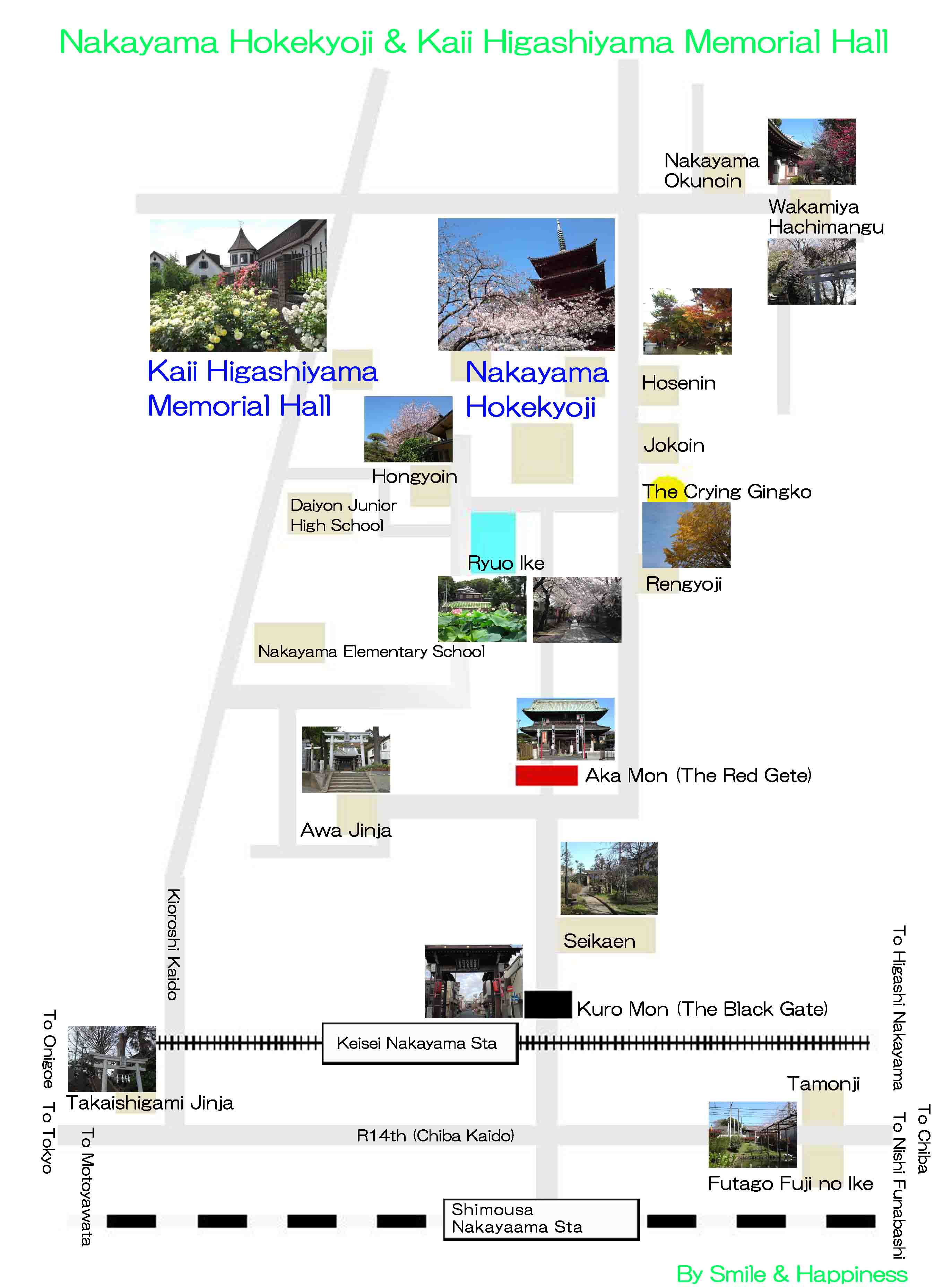
The map near Nakayama Hokekyoji and Kaii Higashiyama Memorial Hall
PDF of the Map near Nakayama Hokekyoji and Kaii Higashiyama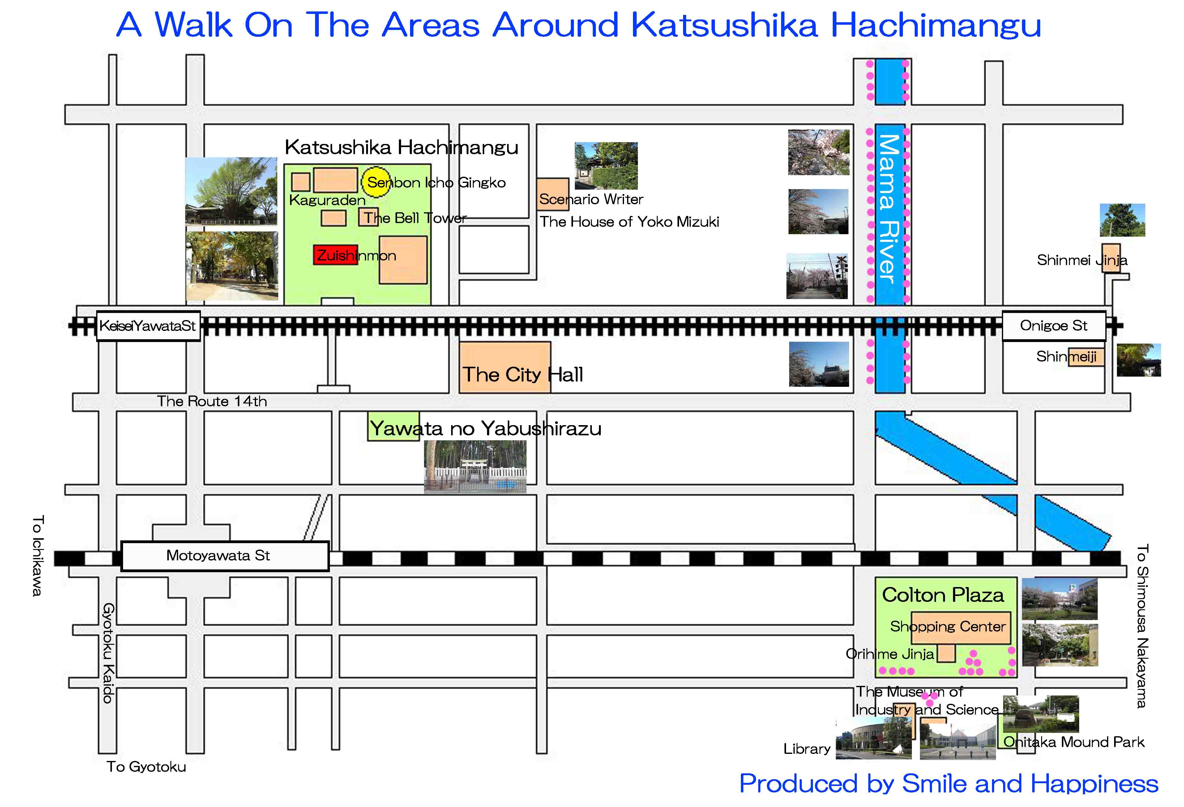
The Map to Katsushika Hachimangu
PDF of the Map around Katsushika Hachimangu and Yabushirazu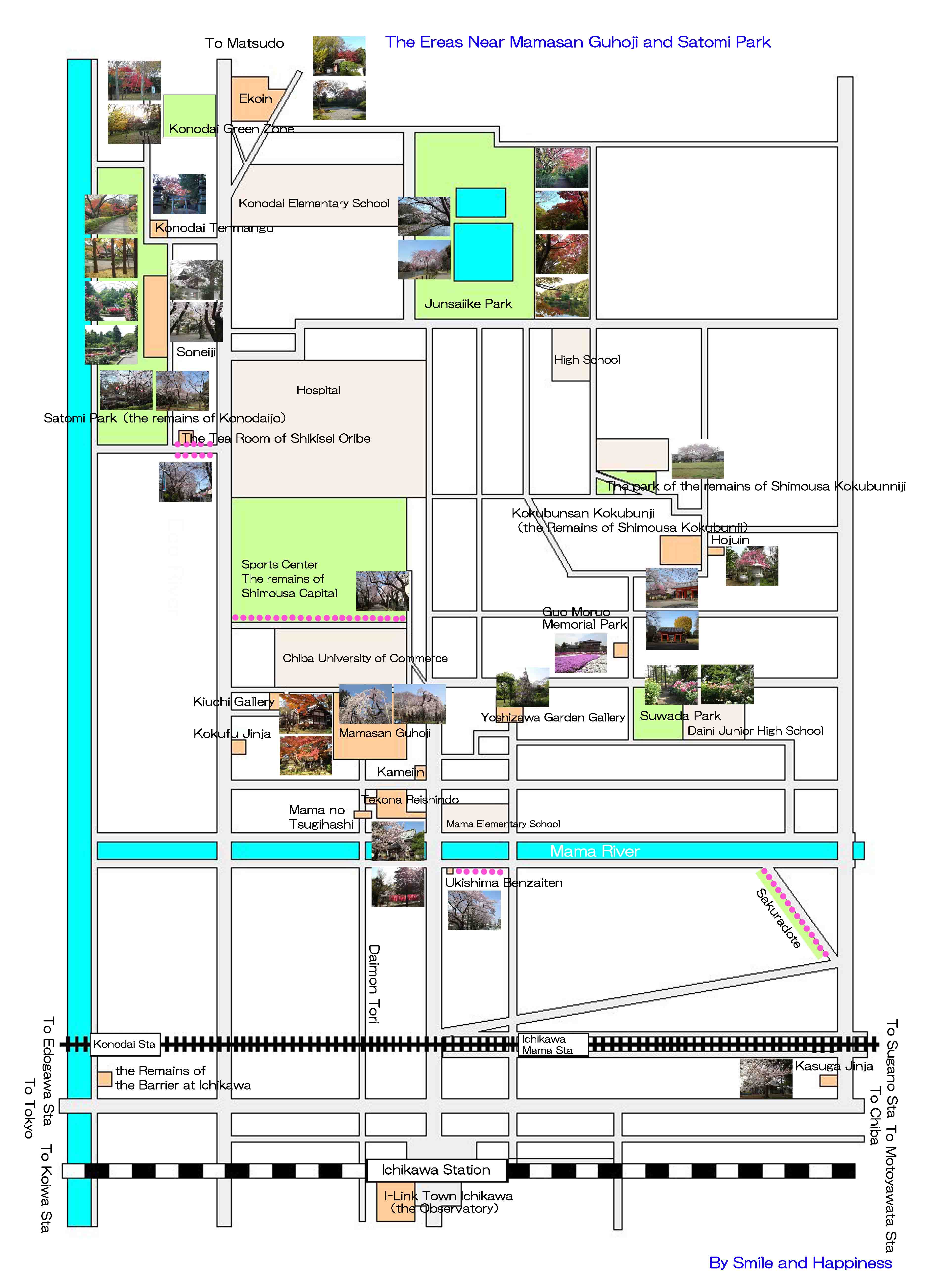
The map near Mamasan Guhoji and Satomi Park
PDF of the map around Mamasan Guhoji and Satomi Park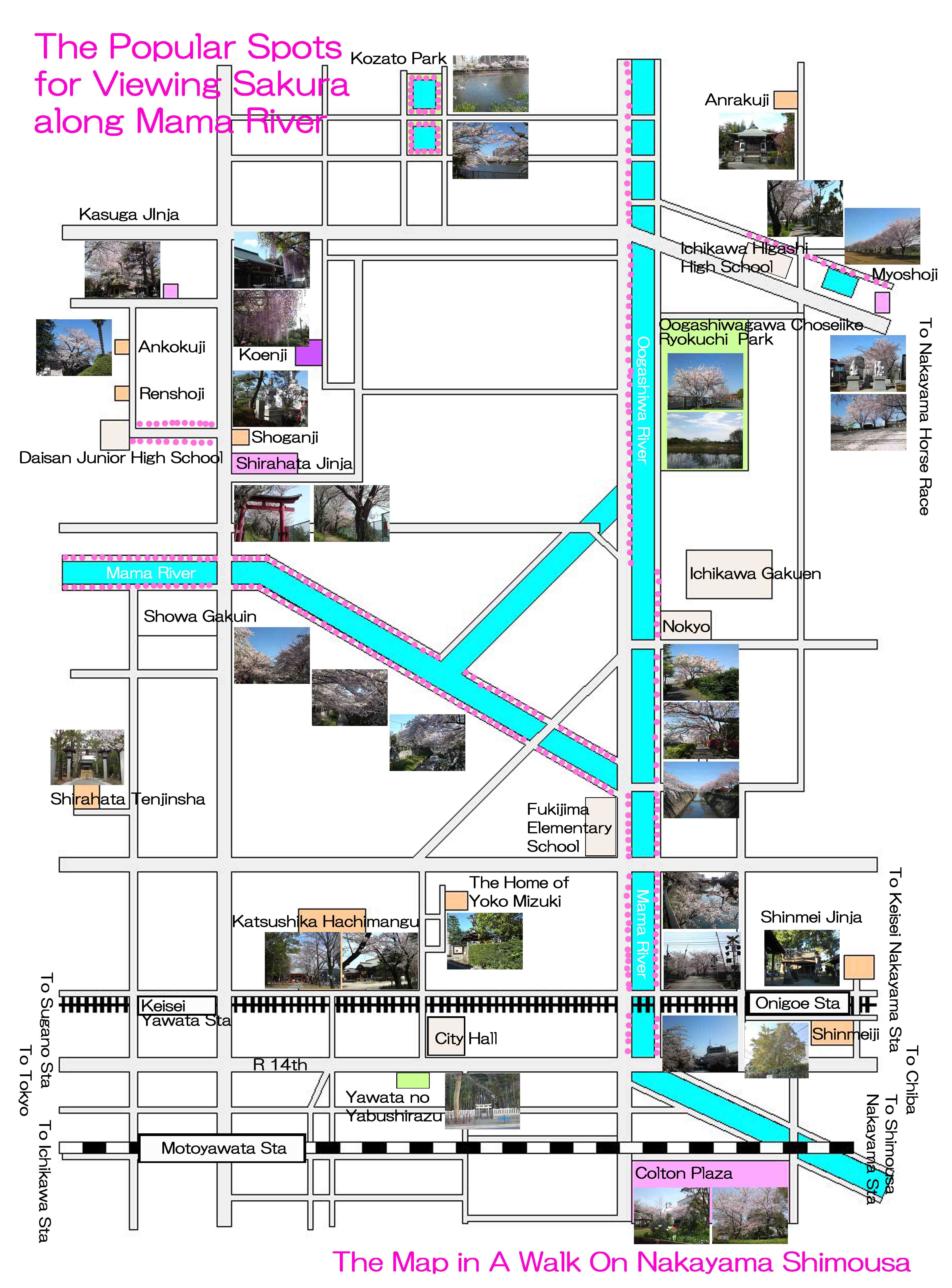
The map to the noted spots along Mama River
PDF of the map to the noted spots along Mama River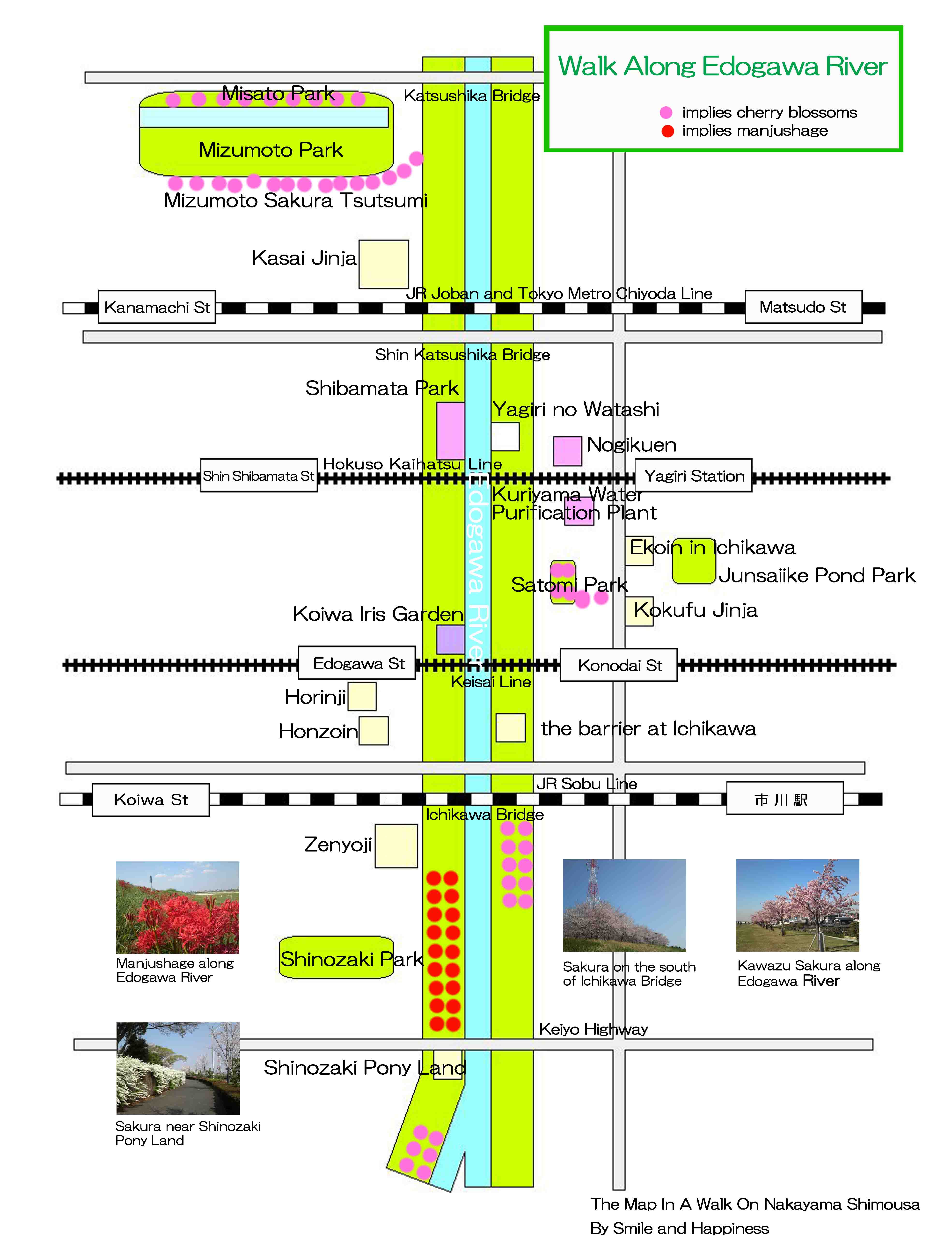
The map to the noted spots along Edo River
PDF of the map to the noted spots along Edo River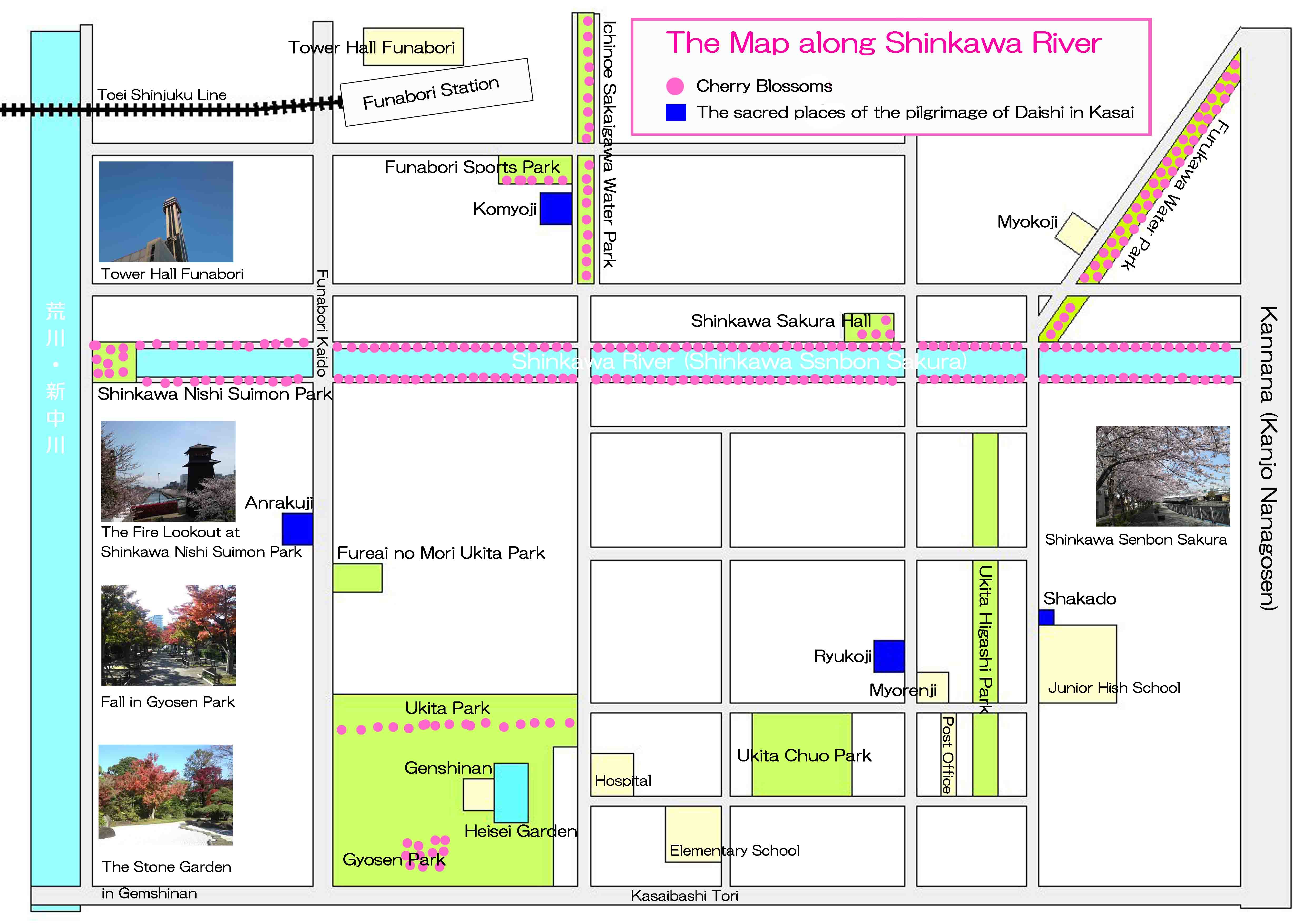
The Map along Shinkawa River
PDF of The Map along Shinkawa River and Shinkawa Senbon Sakura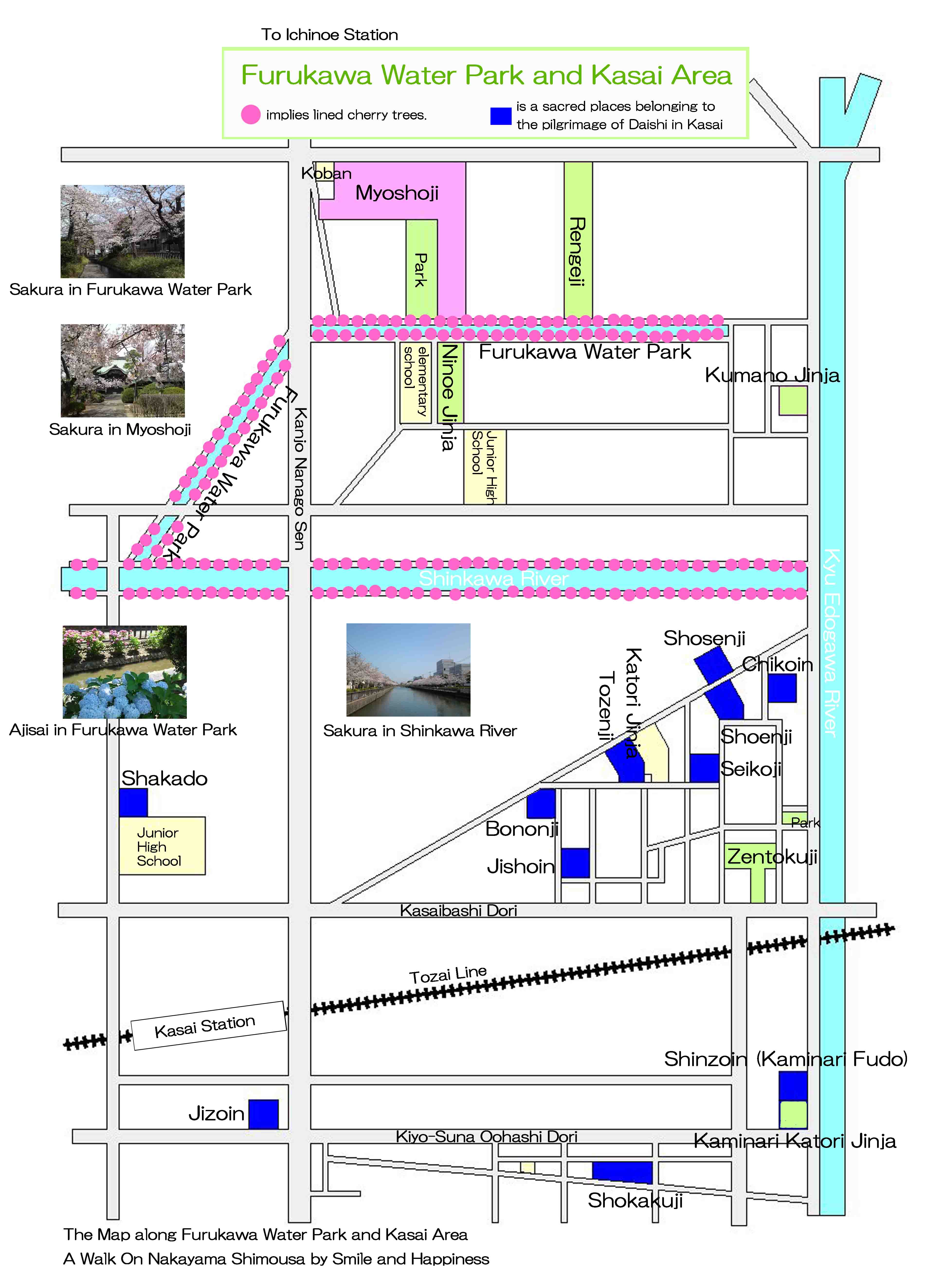
The map to the noted spots along Furukawa Water Park and Kasai
The Map of the landmarks along Furukawa Water Park and in Kasai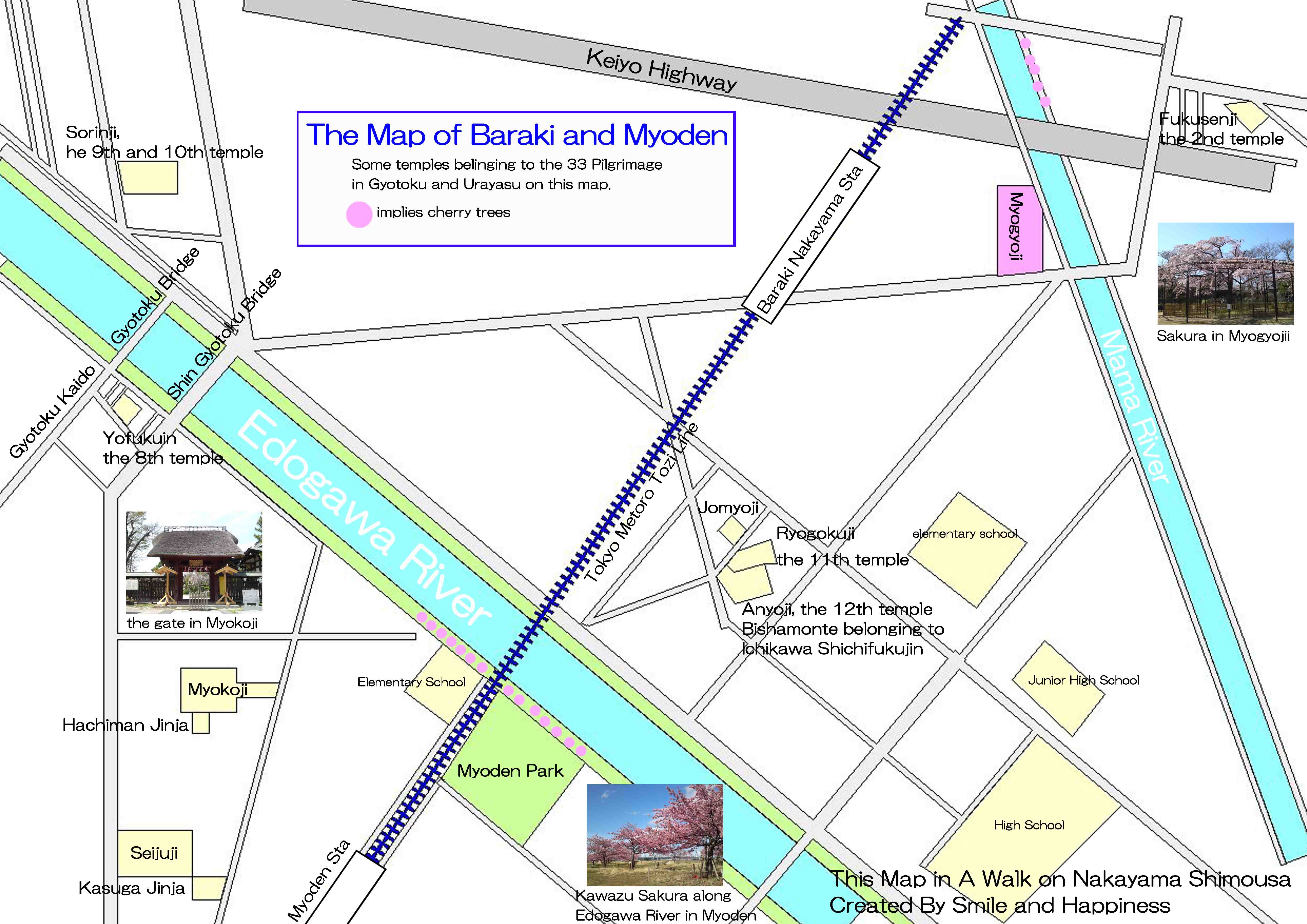
The map to the noted spots in Baraki and Myoden Areas
The Map to the landmarks in Baraki Nakayama and Myoden Areas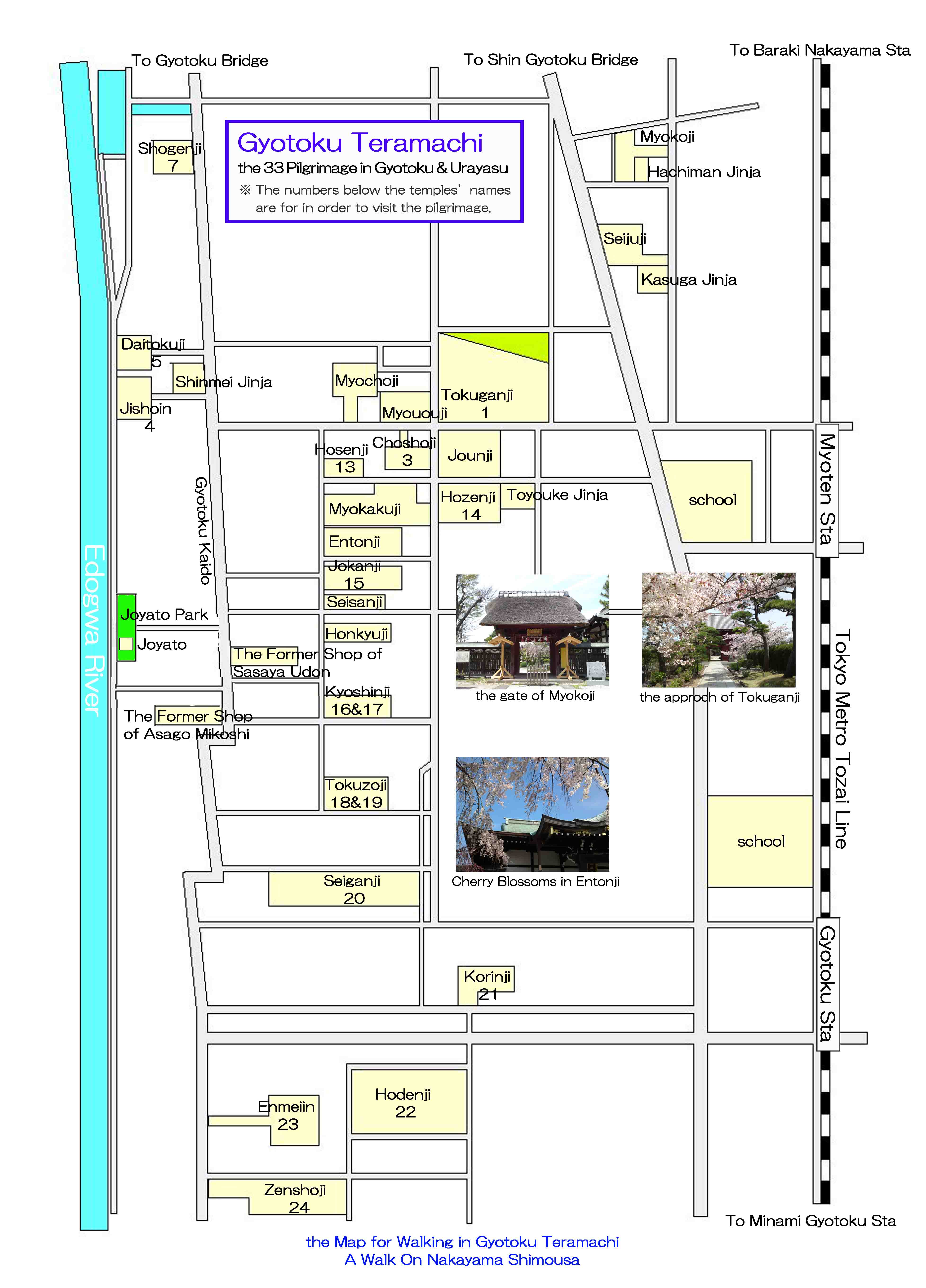
The map to the noted spots in Gyotoku Teramachi Areas
PDF of the Map to the landmarks in Gyotoku Teramachi Areas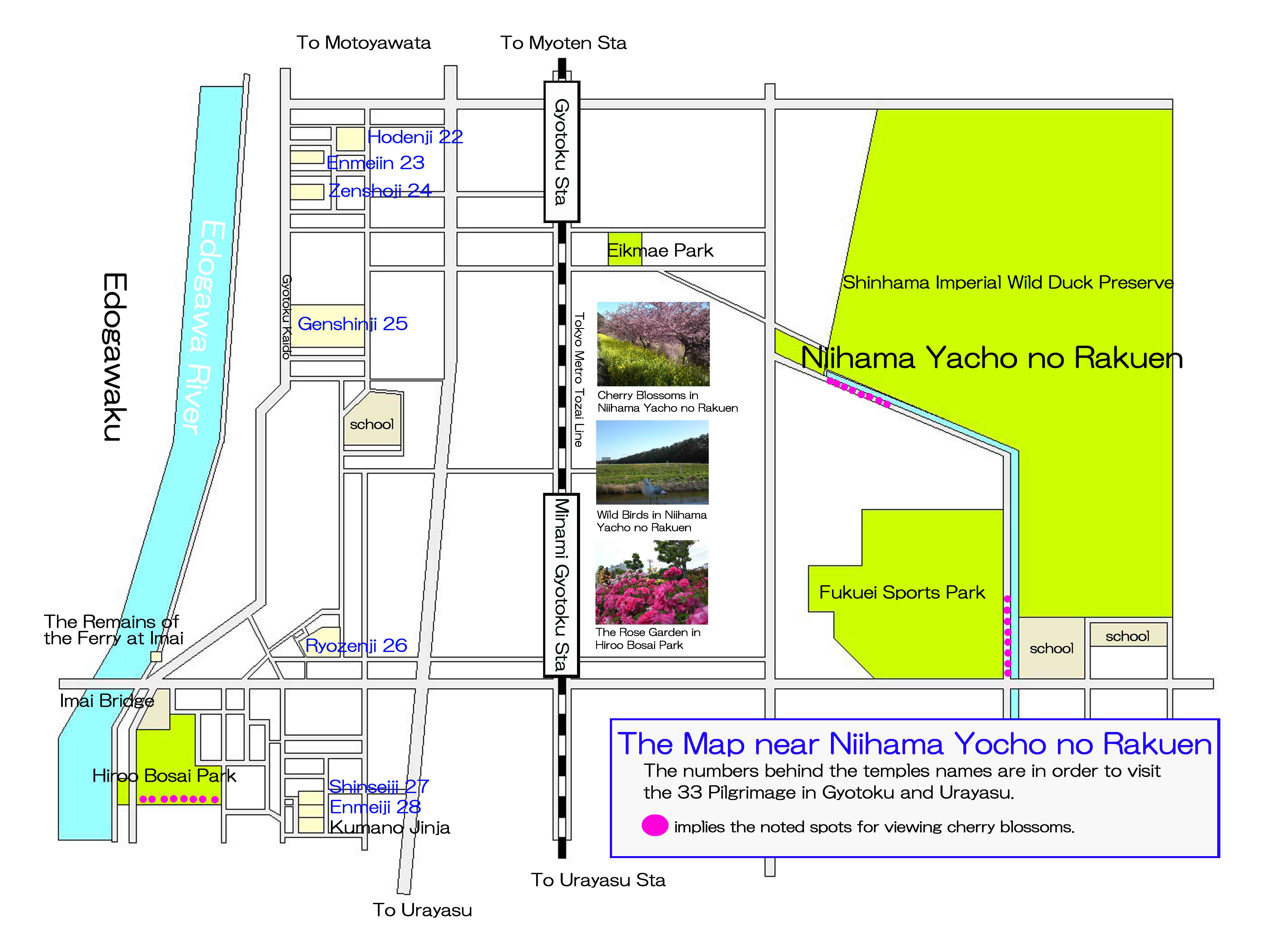
The map to the noted spots near Niihama Yacho no Rakuen
PDF of the map to the landmarks near Niihama Yacho no Rakuen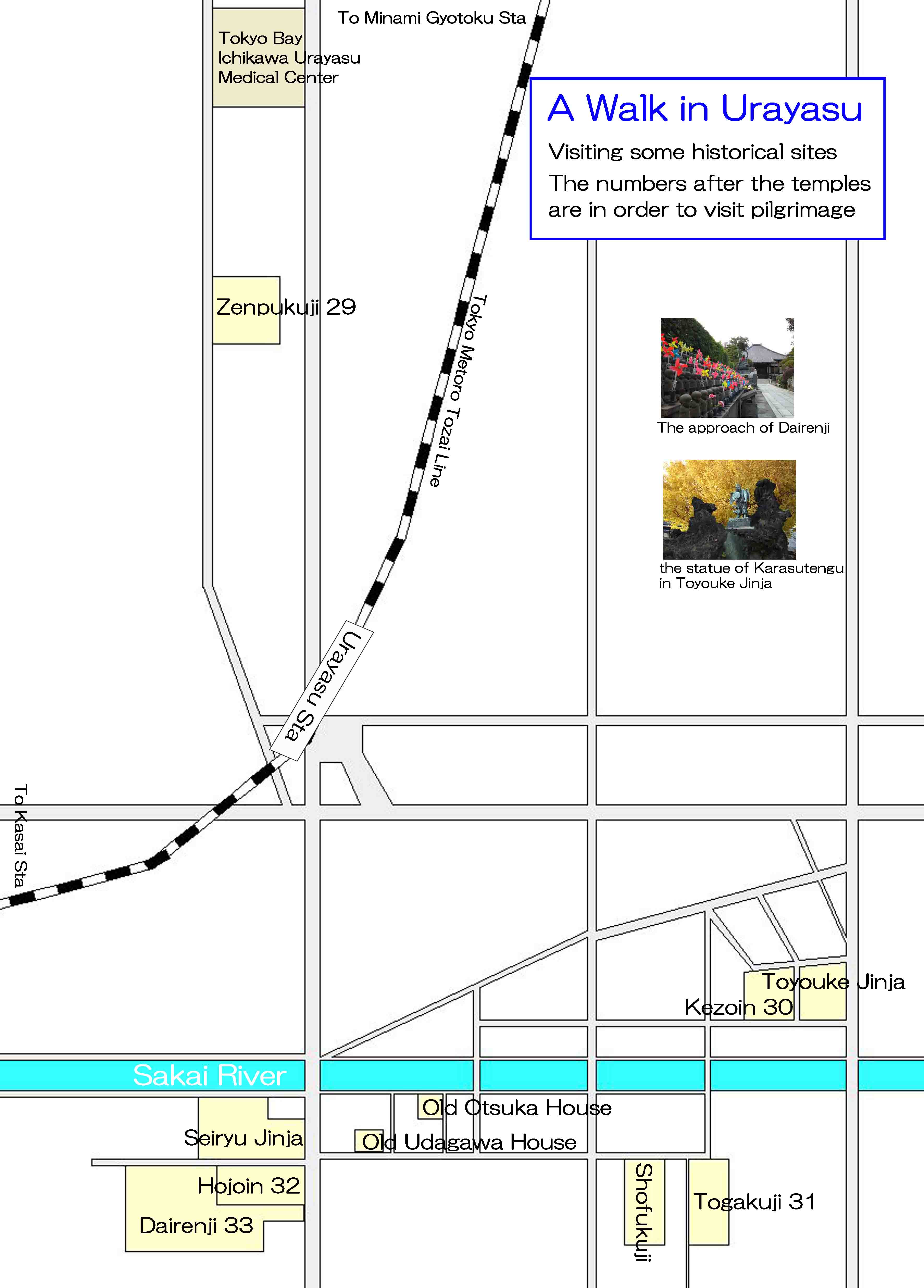
The map to the noted spots near Urayasu Station
PDF to the map of the landmarks near Urayasu Station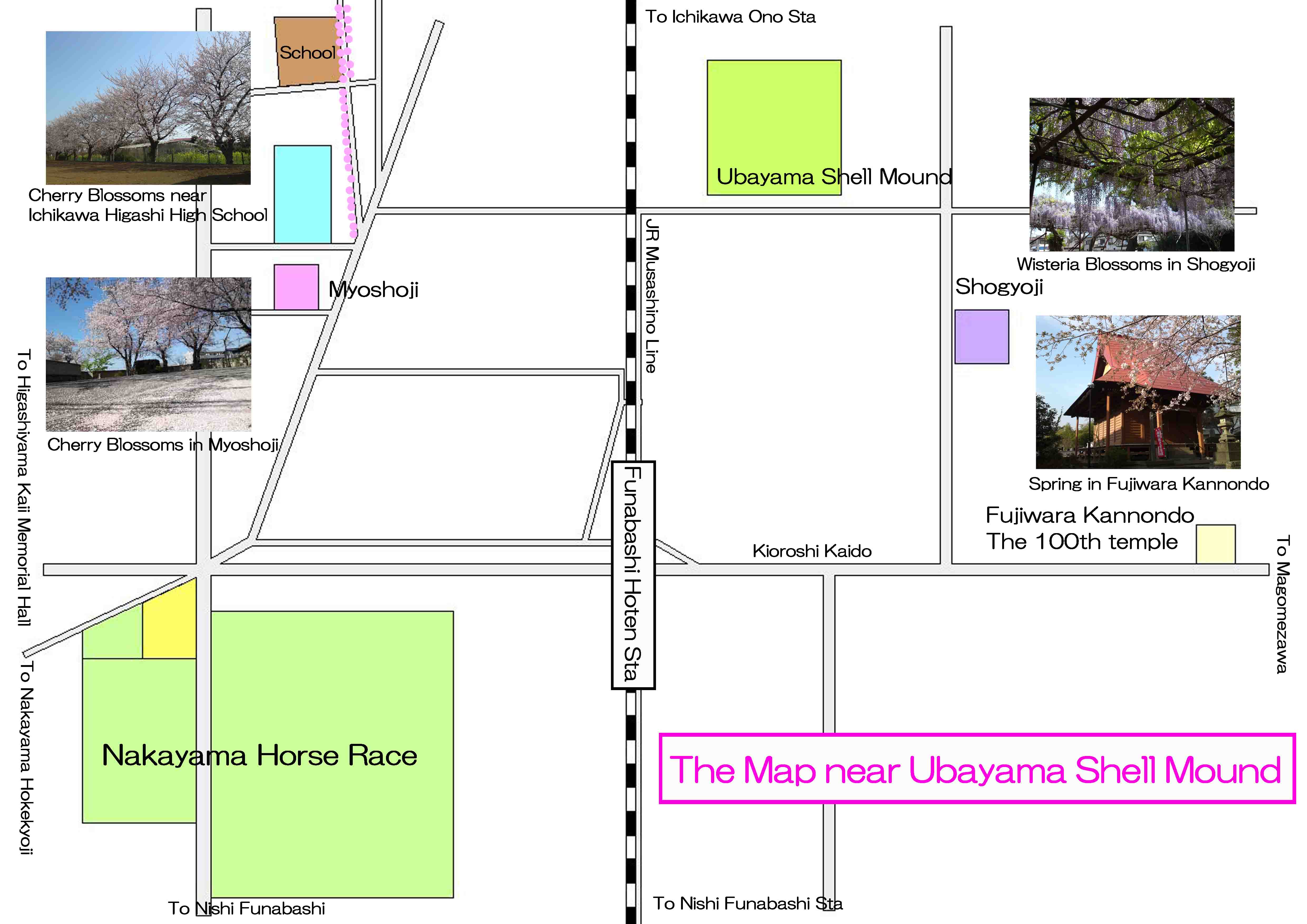
The map to the noted spots near Ubayama Shell Mound
PDF of the map to the landmarks near Ubayama Shell Mound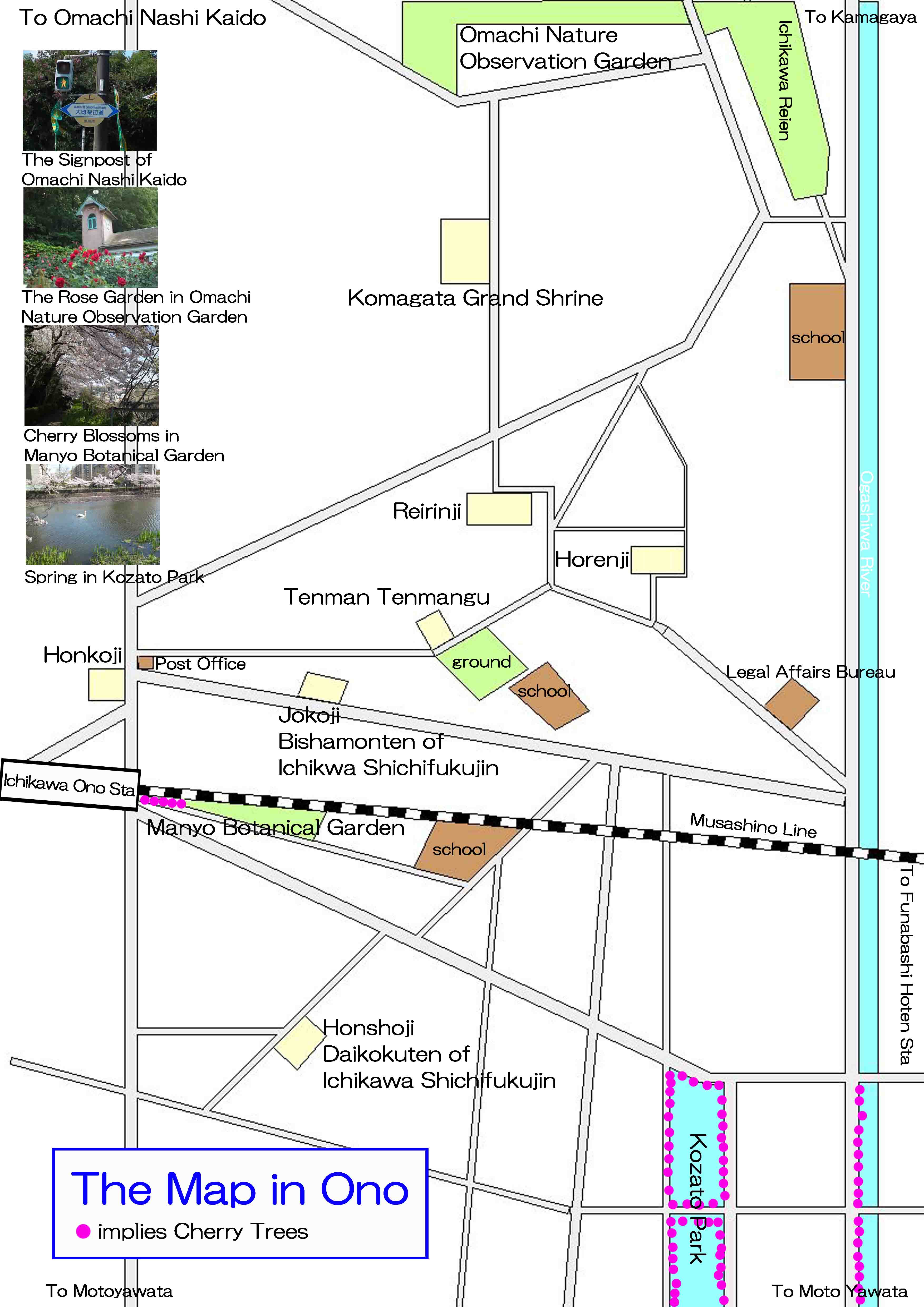
The map to the noted spots near Ichikawa Ono Station
PDF of the map to the landmarks near Ichikawa Ono Station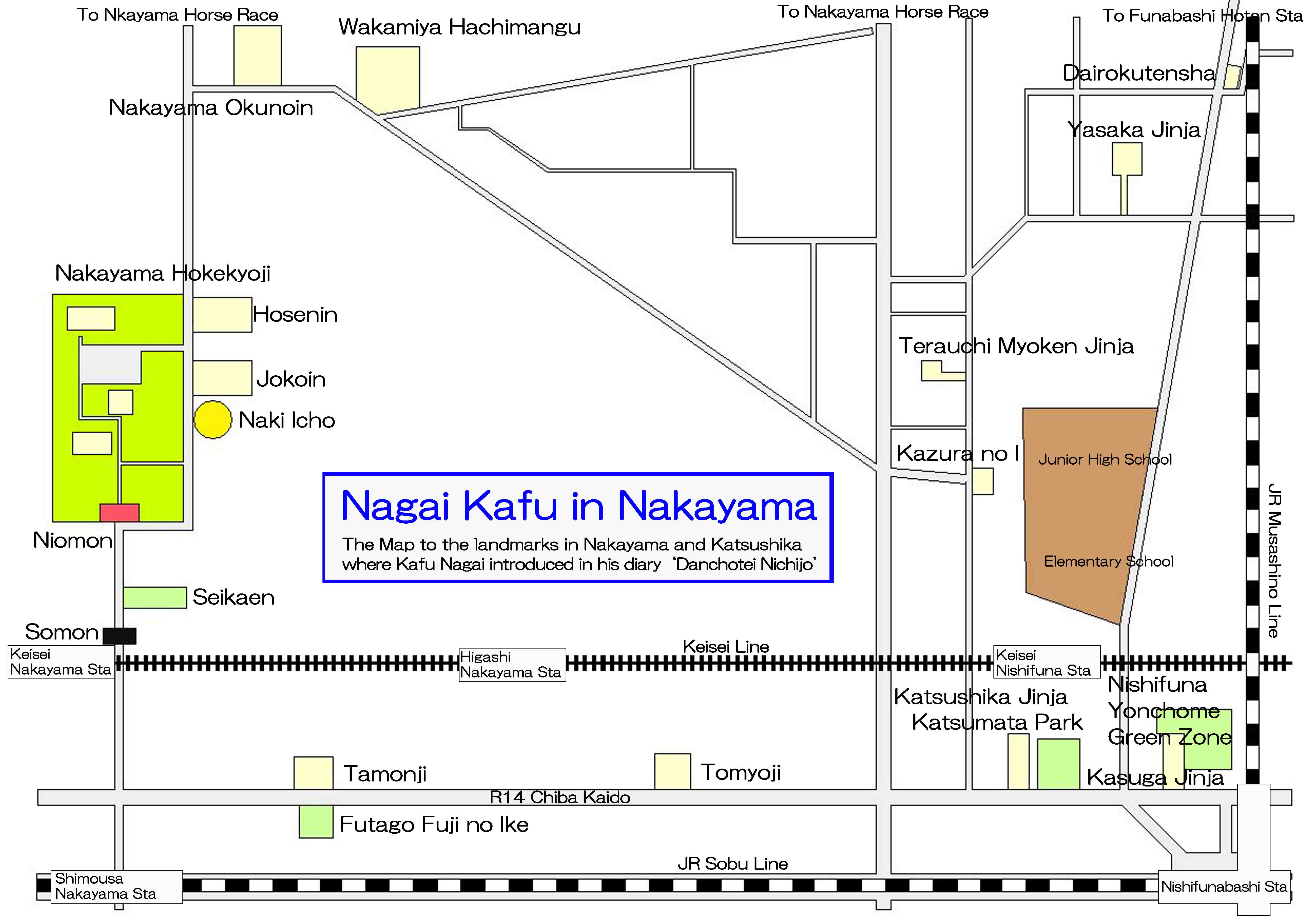
The map to the landmarks where Kafu Nagai introduced in his book
PDF of the map to the noted spots where Kafu Nagai visited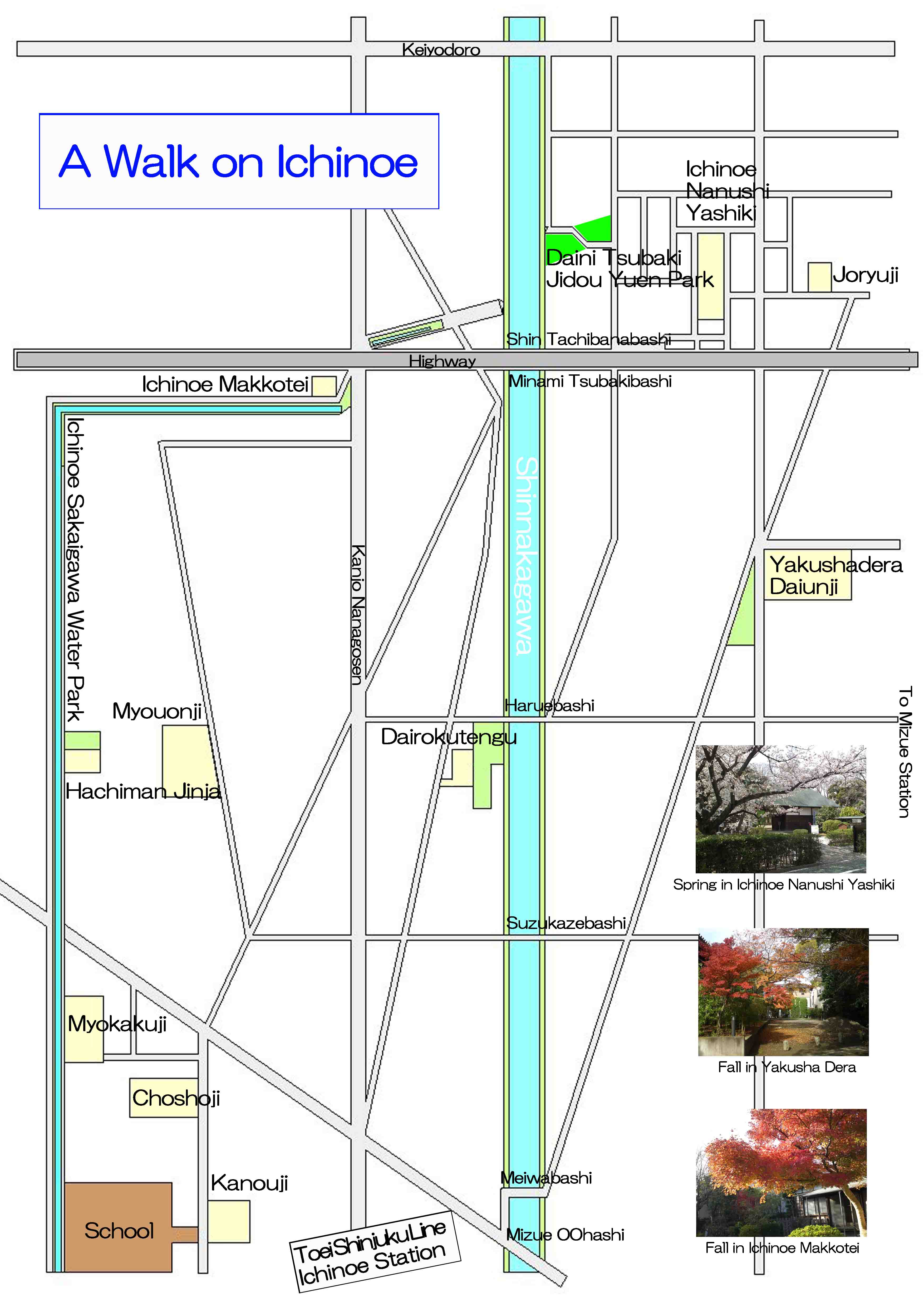
The map to the noted spots near Ichinoe Station
PDF of the map to the noted spots near Ichinoe Station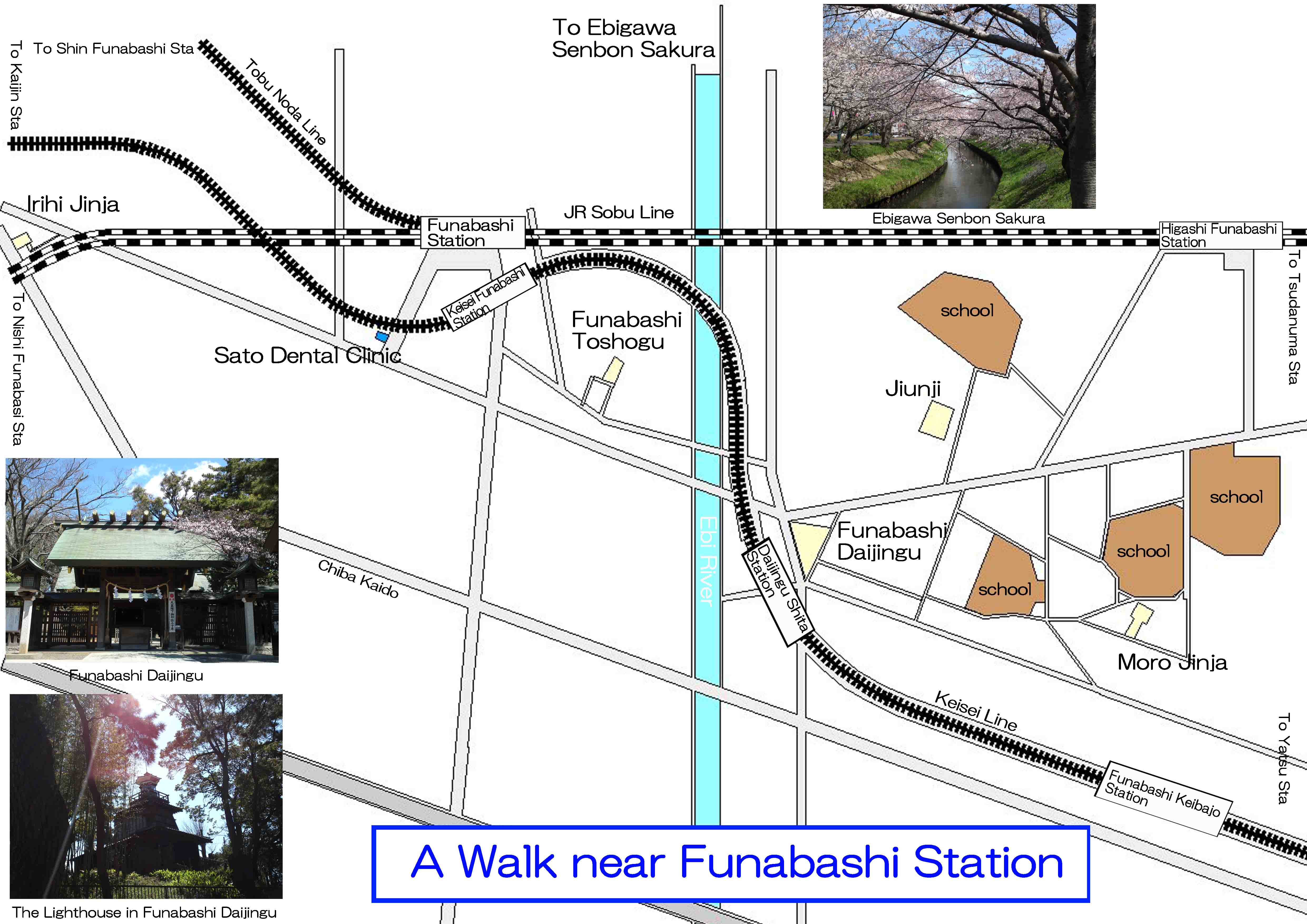
The map to the landmarks near Funabashi Station
The map to the noted spots near Funabashi Station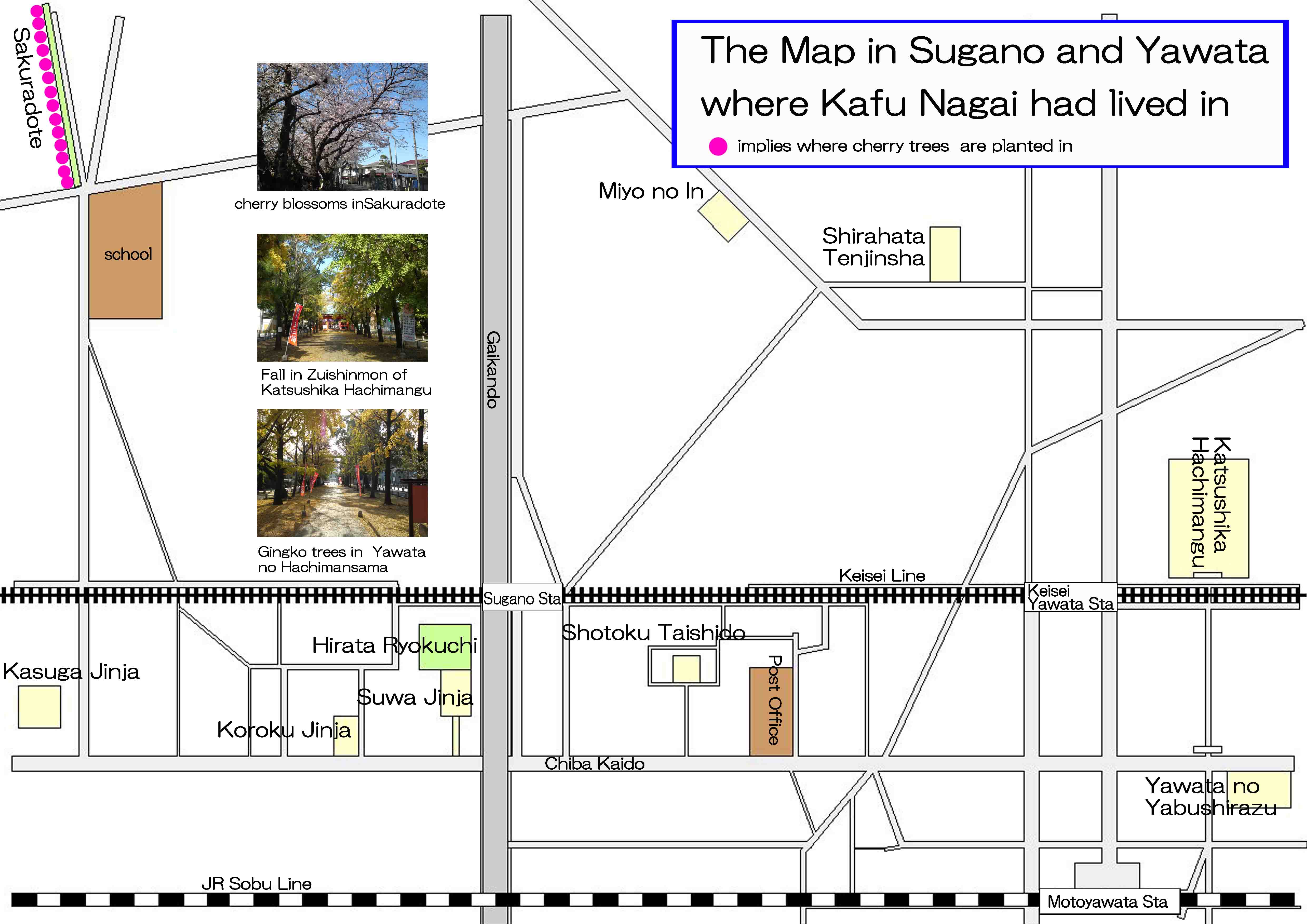
The map in Sugano and Yawata where Kafu Nagai having lived in
The map to the landmarks related to Kafu Nagai in Sugano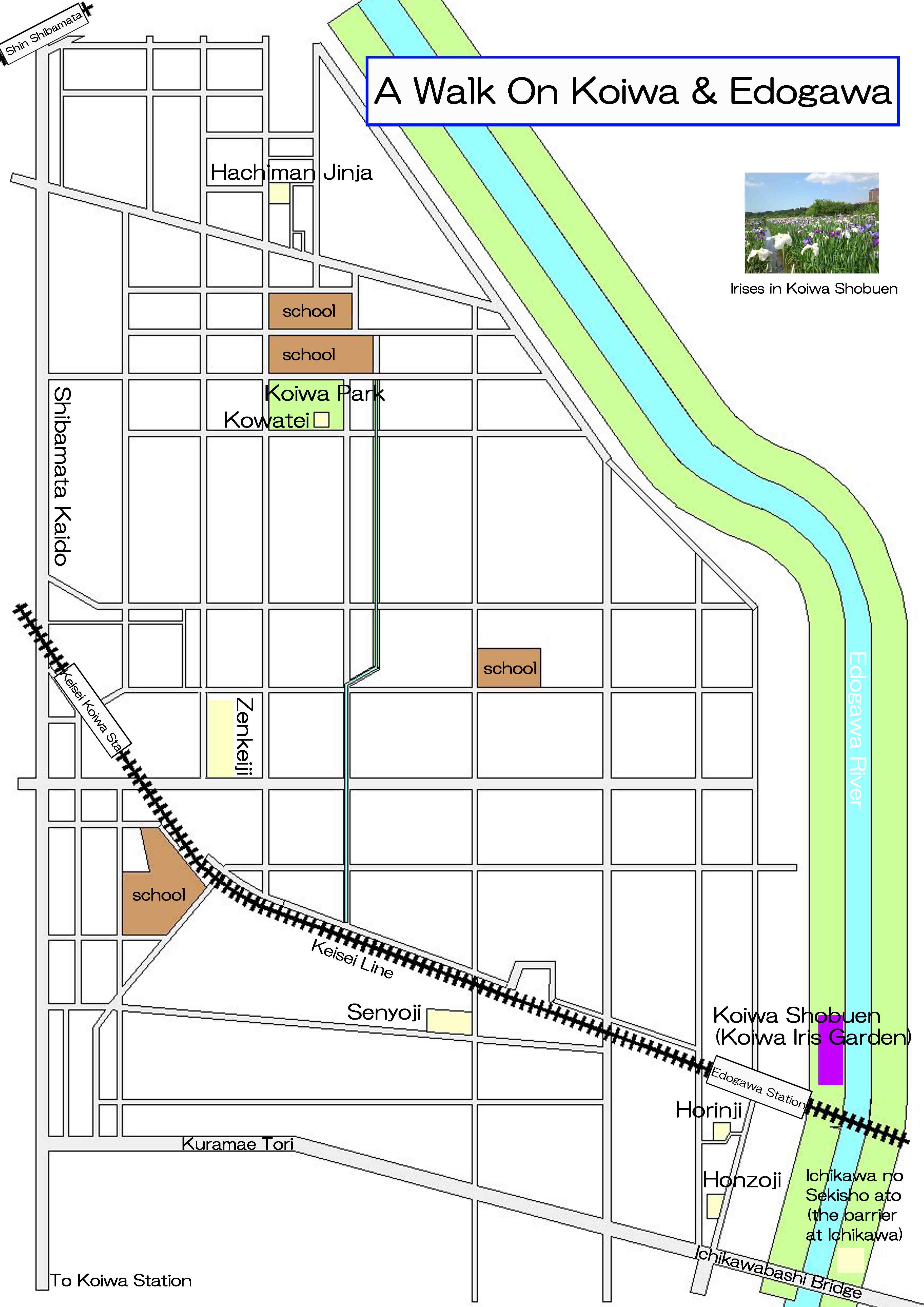
The map to the noted spots near Keisei Koiwa and Edogawa Station
PDF of the landmarks near Keisei Koiwa and Edogawa Station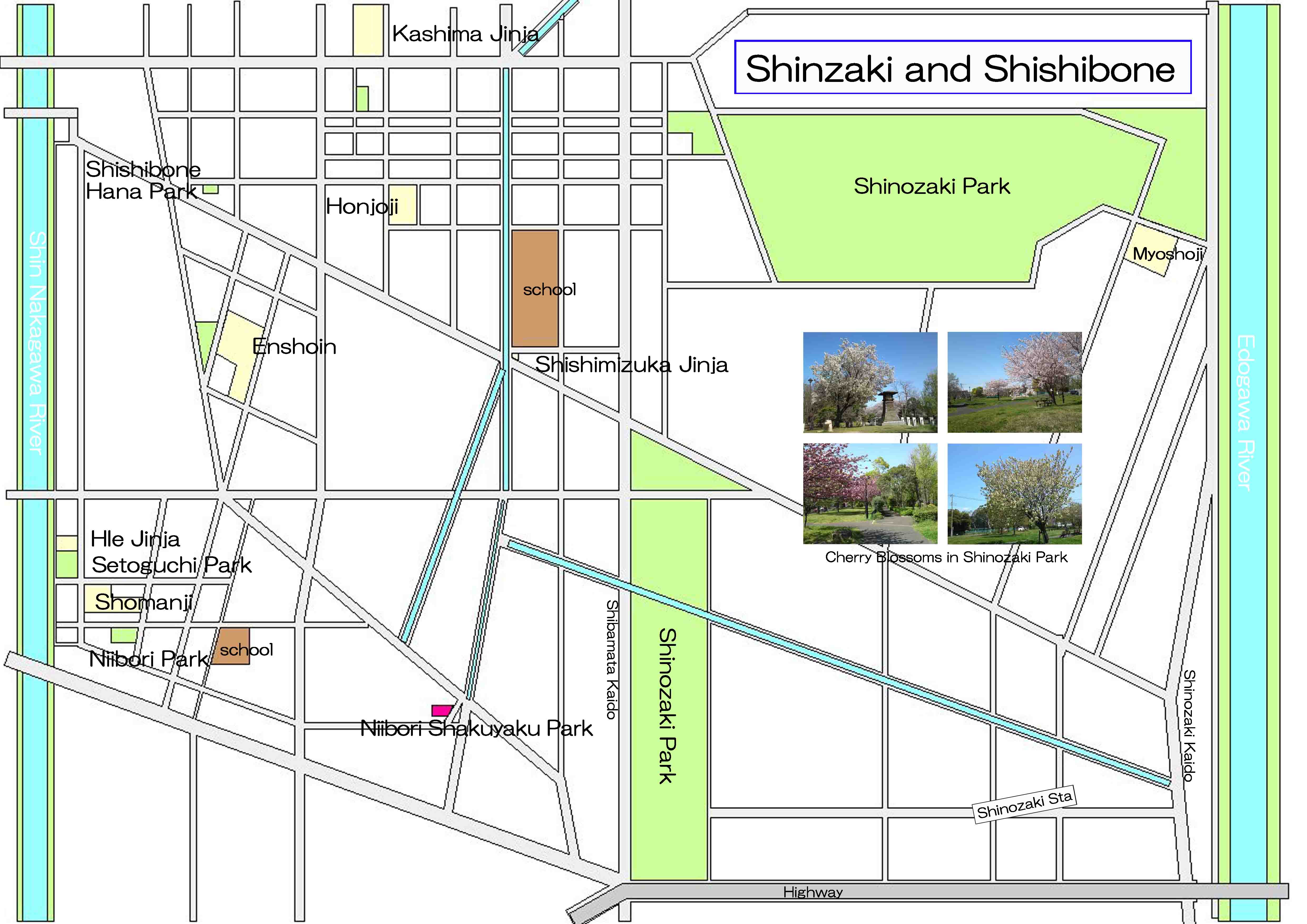
The map to the noted spots near Shinozaki Park and Shishibone
PDF of the map to the landmarks near Shinozaki and Shishibone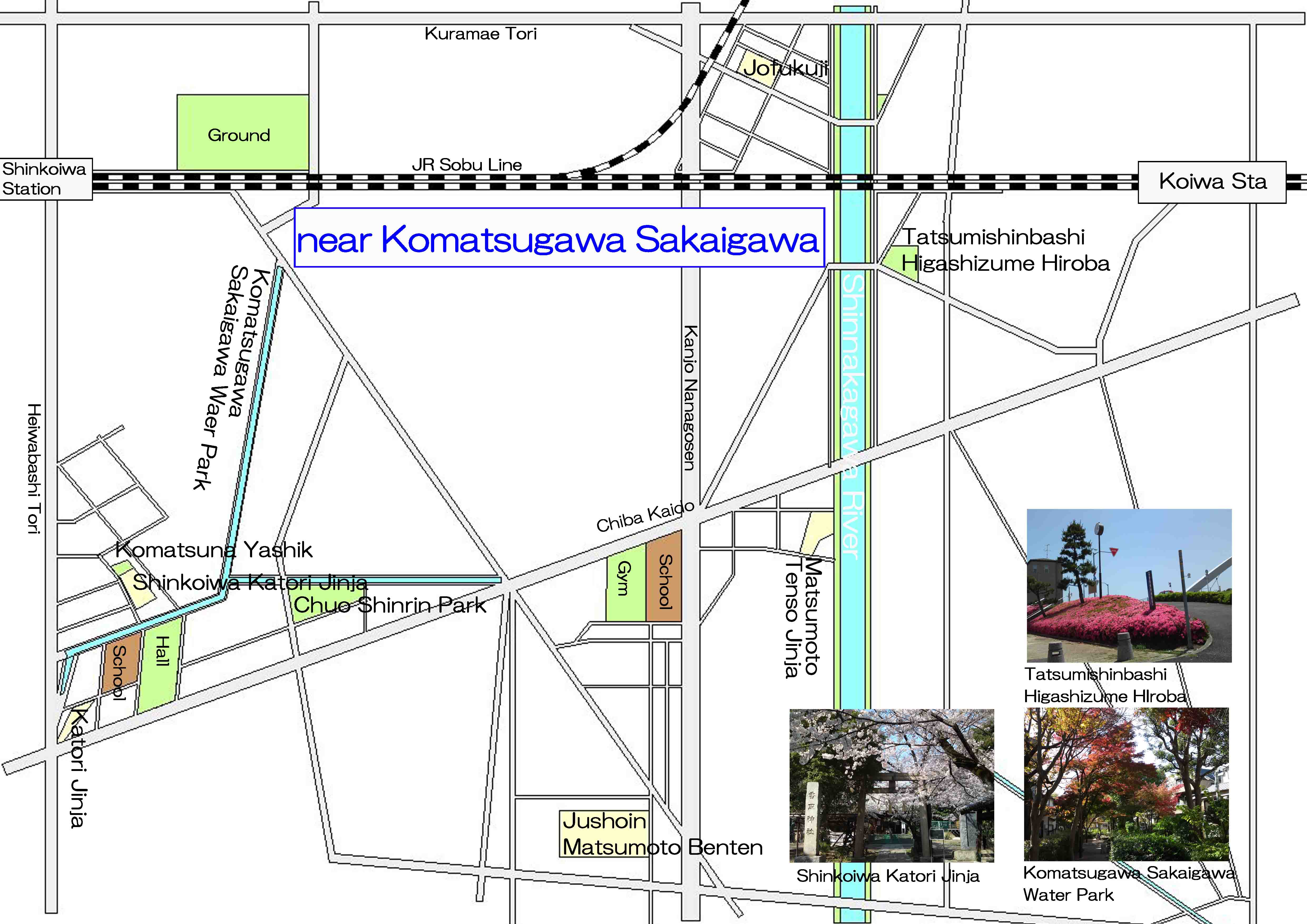
The map to the noted spots near Komatsugawa Sakaigawa Water Park
PDF of the map to the landmarks near Komatsugawa Sakaigawa Warer Park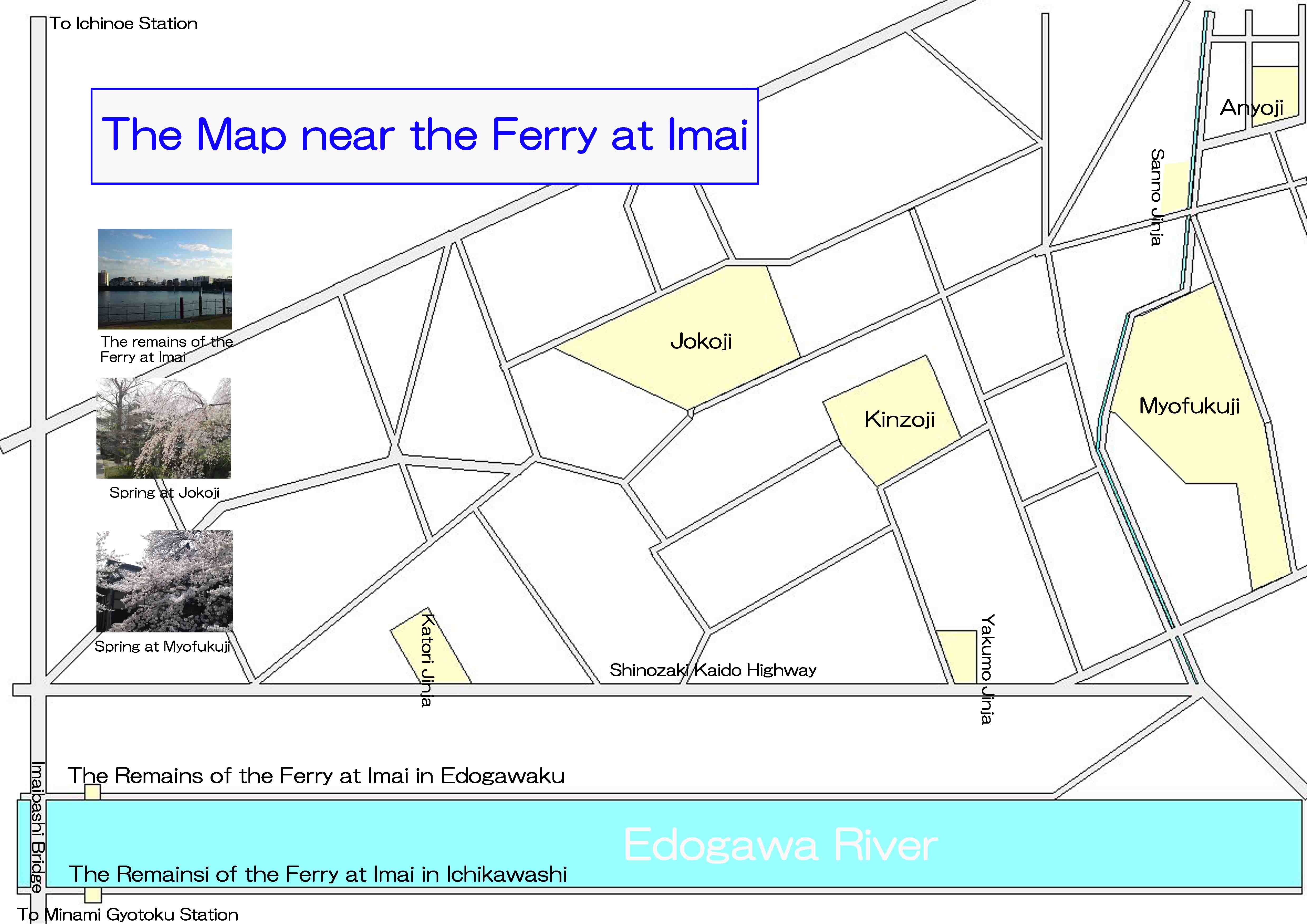
The map to the noted spots near the remains of the Ferry at Imai
PDF of the map to the landmarks near the remains of the Ferry at Imai (Imai no watashi ato)- 広告 Advertisement -